|
The
Outer Banks, then West!
.
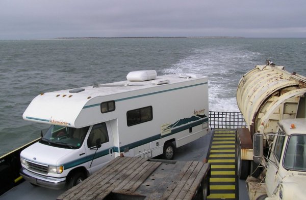
I said goodbye to Beaufort and set sail for the Outer
Banks. I say "set sail" because I had to drive
my RV onto one ferry to get to those sandbank islands
and onto another to traverse them. Until a few decades
ago, the Outer Banks were very remote, reachable only by
boat. Then a bridge was built from the mainland near the
northern end of the chain, more bridges were erected to
connect one island to the next, and the National Park
Service laid claim to most of the land. The southern,
most remote island of the group, Ocracoke, was too far
to connect by bridge. Today, state-run car ferries carry
tourists and commuters to and from that outpost making
it an easy and popular tourist destination.
|

|
All of
this was done in the name of progress. However, that's usually a
double-edged sword. There are still villages on each of the
Outer Banks islands, but from what I saw they have
entirely lost their former primitive individualism and renegade
charm, having been invaded and conquered by modern-day merchants
and developers. Each village now looks pretty much like the
other, and like most other small tourist towns on the Carolina
coast. The buildings are generally recent vintage, their siding
painted gray to imitate weathered timber without really being
messy. It's a sterile, neo-rustic look with little character and
no authenticity. This ubiquitous blandness seems to prevail
throughout much of the coastal southeast states these days.
Thankfully,
the National Park Service protects most of the Outer Banks,
allowing development only in the established villages sprinkled
along the narrow islands. There is still plenty of natural,
unspoiled terrain to see and appreciate.
I camped
that night at the end of a little-used dirt road. I had intended
to be a nice guy and pay to stay in the National State Park
campground because I know how fussy Park rangers can be about
doing otherwise on their turf. However, when I got there I found
the campground was not yet open for the season. Well, what was I
to do, go back to the nearest town and pay to stay in a
commercial campground? I don't think so.
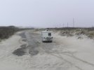
Instead, I
followed my natural nose for roads less traveled. This time it
led me down a one-lane sand track I noticed sneaking off the
main road not far from the campground. It wound through scrub
growth and stunted dunes for maybe a half-mile before coming to
an abrupt end at a tiny clearing on the shores of Ocracoke
Sound, away from the thunderous pounding of the ocean-side surf.
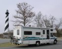
There was just enough space to maneuver my 24' van into a
comfortable position for the night, bow facing back the way I
had come, still leaving room for a car to turn around should one
come along. None did, and I spend my very first
out-in-the-boondocks evening in this RV without incident. It
seemed a good portent of things to come.
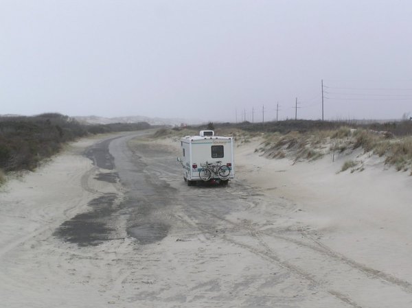
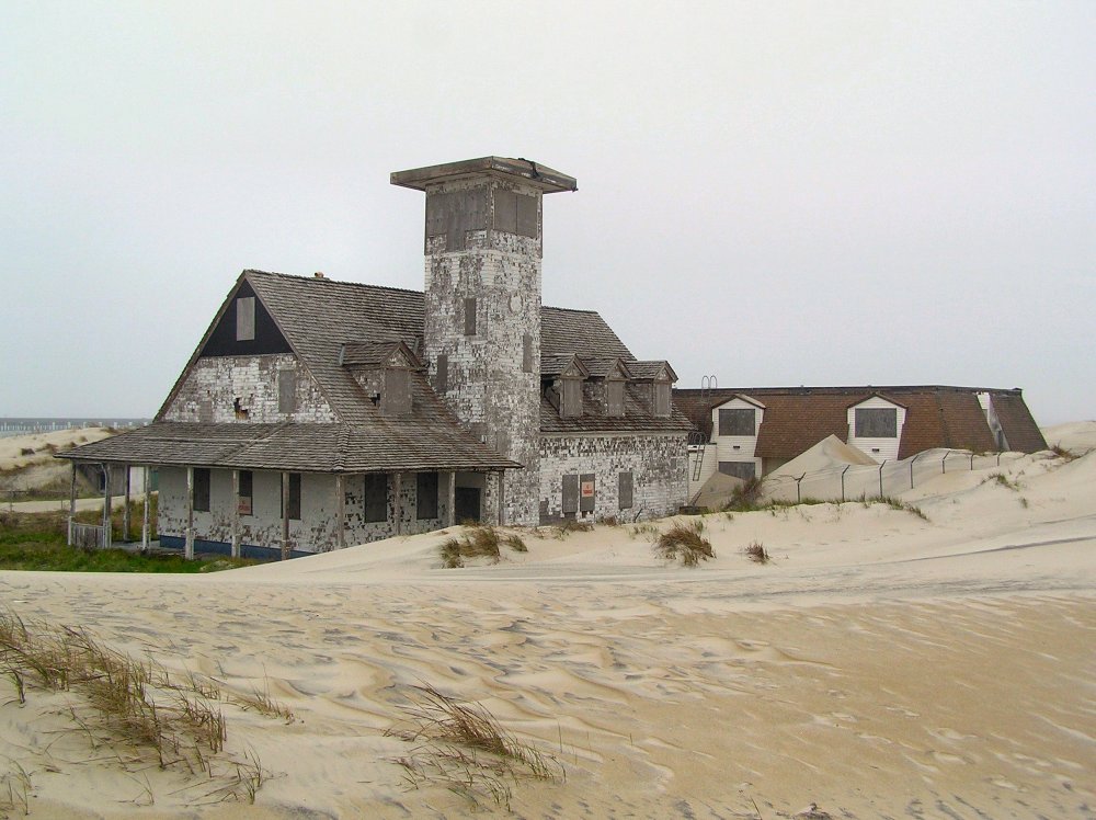
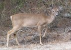
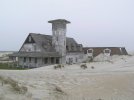
The next
morning I made an abbreviated tour of the Outer Banks, stopping
at a few interesting sites while lamenting the total absence of
the eccentric character and characters that once made the place
architecturally and anthropologically unique. Still, the long
stretches of National Park land allow ample access to the
hundred-odd miles of wide and (this time of year) virtually
empty beaches that are the real magic of the place, featuring an
in-your-face encounter with the Atlantic Ocean.
Click
photos to enlarge
 |
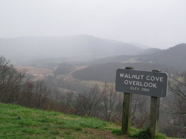
I
left the Outer Banks by midday and swept across NC to
Ashville in the Blue Ridge Mountains. There I found a
friendly ranger lady in the National Forest office who
suggested several scenic routes I might take through
the mountains. I hoped to spend a few days in the
woods, maybe more. I also discovered a cozy cafe in
Ashville, a free wi-fi hotspot. So I was able to send
and receive email before heading for the hills.
|
The Blue
Ridge Parkway is one of America's gems, a well-maintained
two-lane road that winds through pretty rolling mountains.
However, I think I might have enjoyed it a bit later in the
season. As it was, an hour down the road I suddenly found myself
in the maws of a blinding snow blizzard. The pavement
disappeared beneath a white blanket, making it very hard to
follow. I slowed down to a crawl, but even so the RV went into a
skid on a tight, downhill curve. To my right the mountainside
dropped off steeply, no telling how far to the bottom. To
my left was a solid wall of trees broken only by the occasional
rocky outcrop. For a moment I thought I was headed for one or
both, then the van glided to a graceful halt near the shoulder.
I sat for a moment until my breathing steadied, then carefully
turned around and crept back the way I'd come, out of the
mountains and the snow, and got myself onto the interstate
highway westbound. So much for the scenic route so early in
the season.
Running
Down the Latitude
Before the
advent of the chronometer seagoing navigators were not able to
calculate longitude, how far east or west they were. They could,
however, determine their latitude at sea, the distance north or
south of the equator, and they generally knew the latitude of
their next port of call. So they could find the harbor of, say,
New Amsterdam simply by sailing to the latitude of that city
anywhere in the Atlantic Ocean and then setting a course due
west until they reached the coast. Viola! There would be
New Amsterdam. This form of navigating was, and still is, called
running down the latitude.
I spent
the next several days "running down I-40" westward
from North Carolina. It happened to approximate the latitude of
the spring season that week. At least, it did when I set out
upon it.
Normally,
whether I'm cruising in an RV or a boat, I prefer to visit
places off the beaten track, and so I tend to avoid driving on
interstate highways. Interstates afford virtually no contact
with the land through which they pass and have about as much
character as cardboard. Instead I stick to secondary roads and
local routes to see what life is like in the countryside.
However, when it comes to driving a vehicle long distance in a
relatively short time, you just can't beat the great American
interstate highway system.
I passed
without incident through Tennessee, Arkansas, Oklahoma and the
Texas Panhandle. About the time I crossed into eastern New
Mexico I came down with an intestinal bug and spent a whole
afternoon and night in bed in some generic rest area, shivering
with chills and scurrying to the toilet every 15 minutes. I
didn't eat for 36 hours. The following morning I awoke to a snow
blizzard. Someone said it was the first snowfall in this part of
New Mexico this year. Was I bringing this stuff with me?
I-40
became dangerous. Cars were pulling (or skidding) off onto the
shoulder. I even saw an 18-wheeler speeding westward on the eastbound
side of the highway. I guessed he had accidentally entered via
an exit ramp where the signs were covered with snow. I never
learned whether he collided with any oncoming vehicles, but I'll
bet he scared the hell out of a few drivers.
Several
stressful hours later I left I-40 and got onto a secondary
highway north towards Santa Fe. Within minutes, it seemed, I
drove out of that snow blizzard altogether, across open range
that soon showed no signs of it having snowed at all, as if the
blizzard had been restricted to the Interstate. By mid-day I was
rolling into sunny Santa Fe.

Next
Entry: 04/12/04